A Matrix-Matched Semiquantification Method for PFAS in AFFF-Contaminated Soil
The LURCH project PFClean has published a new paper: A Matrix-Matched Semiquantification Method for PFAS in AFFF-Contaminated Soil. Catharina Capitain and Melanie Schüßler from the Faculty of Geosciences at the University of Tübingen spoke to LCGC International about their work.
16/04/2025
.png)
__________________________________________________________________________________________________________________________________________________________
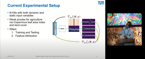
Presentation by Michael Engel at ESA: Assessing the impact of agriculture on groundwater levels based on multiscale analysis
On May 15, 2024, Michael Engel from the TUM Chair of Remote Sensing Technology presented fascinating insights into the KIMoDIs project at the ESA (European Space Agency) conference "EO for Agriculture under Pressure 2024 Workshop" in Frascati, Italy.
Among other things, the project is investigating the influence of agriculture on groundwater levels. Multiscale analysis approaches and the Shapley Value Sampling feature attribution method from the field of Explainable AI were used for this purpose.
05/2024
__________________________________________________________________________________________________________________________________________________________
CHARMANT: New website for the environmental communication sub-project
The CHARMANT joint project has now launched a new website for the environmental communication sub-project. Current activities, flyers, brochures and even an online map with sampling results can be viewed here.
Find out more about topics such as groundwater sampling, well dialogs, round tables and participation workshops!
04/2024
__________________________________________________________________________________________________________________________________________________________
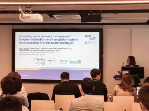
KIMoDIS at the EGU General Assembly in Vienna
The EGU General Assembly from April 14 to 19 in Vienna is dedicated to bringing together scientists from all over the world to discuss a variety of topics in the geosciences. The projects of the BMBF funding measure LURCH will also be represented. On April 14, for example, a presentation from the LURCH joint project KIMoDIs KIMoDIs was shown. The presentation dealt with "The further development of water resource management: findings and implications from global machine learning models in groundwater forecasting" (Maria Wetzel, Stefan Kunz, Maximilian Nölscher, Alexander Schulz, Felix Biessmann, Stefan Broda).
__________________________________________________________________________________________________________________________________________________________
KIMoDIs wins poster prize at the FH-DGGV conference
We are pleased to announce that the LURCH project KIMoDIs has won first place in the poster awards at the FH-DGGV conference!
Project title: "AI-based groundwater management in Brandenburg: necessity and previous developments"
Authors: Dr. Maria Wetzel, Dr. Stefan Broda and Stefan Kunz (Federal Institute for Geosciences and Natural Resources, Germany), Lena Katharina Schmidt and Angela Hermsdorf (Brandenburg State Office for the Environment, Germany), Dr. Tanja Liesch, Benedikt Heudorfer and Fabienne Doll (Karlsruhe Institute of Technology, Germany).
A big thank you to everyone involved and to the FH-DGGV conference for recognizing the efforts of KIMoDIs.
03/2024
.jpg)
__________________________________________________________________________________________________________________________________________________________
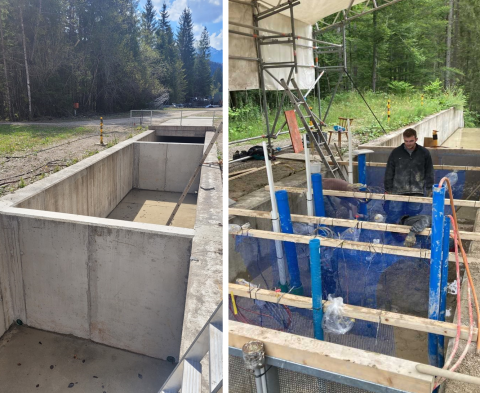
NitratLurch: Starting signal
After a three-month planning phase, work began in early August at the TUM research institute in Obernach to fill the concrete channel, which measures 2.50 m wide, 1.80 m high and 6 m long, in a water-saturated state and install the necessary measurement and sensor technology.
__________________________________________________________________________________________________________________________________________________________
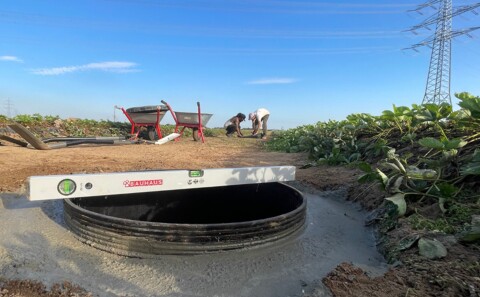
WaRM: Construction of monitoring stations for mass transport processes
Five monitoring stations are being operated as part of the WaRM project. Four stations are used to investigate reactive substance transport processes via the unsaturated zone into the groundwater. At another station, the input of nitrate and a wide range of organic trace substances from ditches influenced by treated wastewater discharges into the groundwater is being investigated.
09/2023
__________________________________________________________________________________________________________________________________________________________
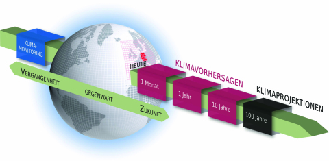
KIMoDIs: Comprehensive database is an essential basis for AI forecasts
In the first few months of the KIMoDIs project, the focus was on designing an intelligent data management system and collecting and processing available data from the pilot regions. This process is of crucial importance, as a comprehensive and high-quality data basis is a prerequisite for the development of data-driven machine learning (ML) models.
__________________________________________________________________________________________________________________________________________________________
IsoGW research project creates isotope directory
Under the leadership of the GeoZentrum Nordbayern at the University of Erlangen-Nuremberg, researchers in the BMBF project IsoGW are working on the first isotope database for groundwater in the whole of Germany.

__________________________________________________________________________________________________________________________________________________________
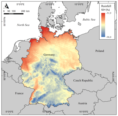
Isotope map (IsoGW)
The LURCH joint project "IsoGW" is working to develop a high-resolution and dynamically adaptable isotope distribution map for stable water isotopes (δ18O and δ2H) and tritium concentrations (3H) of groundwater throughout Germany. This isotope map, also called "isoscape", is not yet available in Germany.
By combining the isotope distributions of precipitation, surface waters and groundwater, hydrological processes such as the recharge of groundwater can be specifically identified and questions about drinking water production from bank filtrate can be answered. The isotope map and the underlying database thus provide valuable tools for sustainable groundwater management in Germany.
The isotope map is produced through comprehensive data research, including existing data from the state offices, literature and new measurement campaigns. The collected data will be compiled in a public database and continuously updated. The long-term goal of the project is to make this data available to the public free of charge and freely accessible.
The development of an area-wide isotope map of groundwater in Germany enables us to deepen our understanding of hydrological processes, especially against the background of changing land uses and climate change. It is an important step towards sustainable use and management of our valuable water resources.
Figure: Distribution map of the deutierum isotopes of rain over Germany (annual mean). Similarly, an isotope map of groundwater is to be created in the future. Data basis: GNIP (Global Network of isotopes in precipitation), IAEA Vienna
__________________________________________________________________________________________________________________________________________________________
Real-time planning tools (GW_4.0)
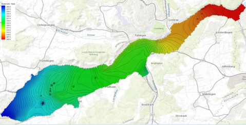
What would it be like to have an online tool with which current groundwater levels can be queried quickly and easily?
This is exactly what is being developed in the LURCH joint project GW_4.0, which enables the merging of soil and groundwater balance models with real-time data assimilation! In the soil water balance model, meteorological data is regionalized in order to calculate seepage water formation. In addition, physiographic data such as altitude, slope inclination and land use are taken into account.
__________________________________________________________________________________________________________________________________________________________
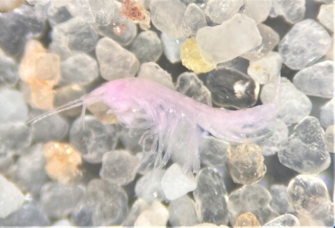
CHARMANT: The groundwater fauna
Did you know that an entire ecosystem lies hidden beneath our feet? Despite complete darkness, lack of space and food, groundwater harbors a variety of fascinating creatures that play a crucial role in the quality of our precious water resource.
Groundwater fauna consists of a wide variety of organisms including tiny microbes, insect larvae, crustaceans, and even small fish. These invisible heroes of groundwater perform important functions.

